
Here at Hale TiP, we are always looking for exciting opportunities to introduce professionals to different technologies that could meaningfully impact their workflow. That is why we were thrilled to give a live UAV demonstration to the Geographic Information Sharing Special Interest Group (GIS/SIG) on June 13th. It was a great opportunity to showcase the ease of data collection using drones as well as explore some of the different processing methods that are available.
The scope of this project included the Sunnyside Lodge and its surrounding area at Black Creek Park in North Chili, NY. To ensure sufficient data collection, Greg Hale P.E. set up two automatic flight paths using the mobile app Pix4DCapture. First, the entire landscape was scanned as the DJI Phantom 4 Pro drone flew in a series of straight lines across the landscape. Afterward, the drone was set on a circular flight path around the lodge to ensure proper coverage of the structure. The initial data scanning took a total of 12 minutes, most of which was automated flight time.
After the data was collected, it was processed using two different pieces of software for comparison; the desktop application Pix4D Desktop and the browser-based application DroneDeploy. The workflow in Pix4D started with the initial processing during which the pictures from the flights were imported and the images were tied together with outliers having been flagged. Upon completion of the initial processing, GPS data collected by Michael P. Arsitz, LS of A&A Land Surveying was added as ground control points in order to more accurately geolocate and scale the project. Once the GPS data was added the project was recalibrated and allowed to generate the point cloud and the 3D mesh. The workflow in DroneDeploy, on the other hand, consisted of uploading the desired pictures to their cloud service and adjusting minimal preset parameters. The results generated did contain some differences. Take some time to explore the 2D and 3D models created in DroneDeploy as well as the model created in Pix4D and compare the results. We have also provided the original pictures from the drone flight and hope that you will use these in your own trial software to generate your own results. We recommend trying DroneDeploy, Pix4D Cloud and Pix4D Desktop, Drone2Map for ArcGIS, or Skycatch. Each of these programs have their pros and cons so be sure to explore them to get an understanding of which best suits your needs.
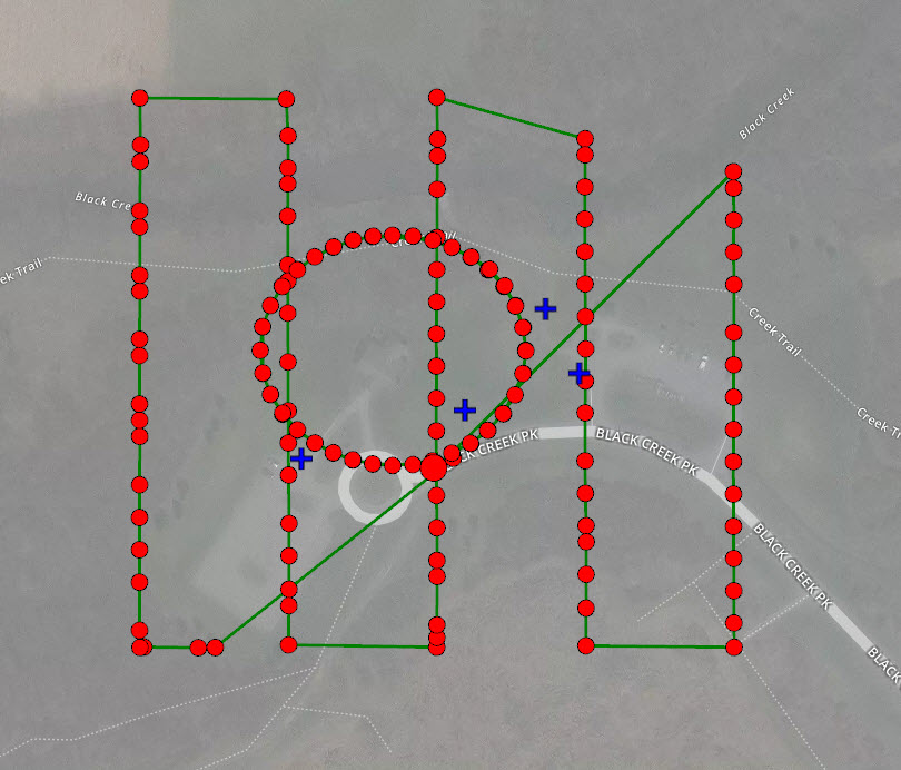
Map showing the automated flight paths

Image from Flight 1

Image from Flight 2


Greg Hale presents to the GIS/SIG

Liftoff!